Catherine Jordan1, Caroline Cusack1, Diego Pereiro 1and Mick Gillooly1
1 Marine Institute, Galway, Ireland
Thanks to funding from the Irish Government’s Department of Agriculture, Food and the Marine (DAFM) and the European Maritime, Fisheries and Aquaculture Fund (EMFAF), the Marine Institute, in Ireland, is working on a project to improve the way we use remote sensing to study the ocean.
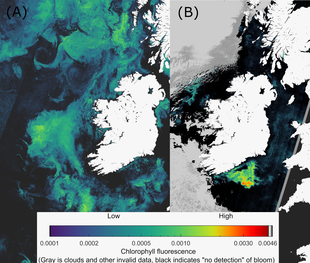
One part of the project is focused on improving how we track changes in the ocean and manage marine resources. A tool called the “Red Band Difference Algorithm”, is now available on a web platform to help the aquaculture industry and scientists monitor phytoplankton blooms in Irish waters. Phytoplankton (microscopic plants) in the ocean can sometimes grow out of control, forming harmful blooms. Daily produced satellite images can help track these blooms by measuring the amount of chlorophyll (the green pigment in plants) in the water (Fig. 1). The Red Band Difference algorithm is used as a proxy of relative chlorophyll-a fluorescence for monitoring phytoplankton blooms in Irish waters. This algorithm is less sensitive to coloured dissolved organic matter, suspended particulate matter and atmospheric corrections, making it a very useful approach to monitor open and coastal waters. The algorithm, as described by Amin et al. (2009) and tested in Irish waters by Jordan et al. (2021), is routinely used by NOAA for Harmful Algal Bloom (HAB) monitoring. The Red Band Difference tool creates satellite images to track these blooms by measuring the amount of chlorophyll fluorescence at the ocean surface.
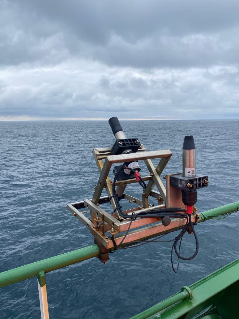
Another part of the project is an upgrade to the equipment used on two national research ships, the RV Celtic Explorer and the RV Tom Crean. The equipment, called hyperspectral radiometers, measures the downwelling light and the light that reflects off the ocean’s surface. These measurements combined determine remote sensing reflectance. This data is important for checking if satellite measurements are accurate.
In early 2025, the system will get a big upgrade. The Marine Institute is working with the Plymouth Marine Laboratory to install a new solar-tracking system that will improve the measurements even more. To further reduce uncertainties associated with data collection, the hyperspectral radiometers will get fully characterised by the Tartu University Lab, Estonia in collaboration with the Fucidal Reference Measurements for Ocean Colour (FRM4SOC Phase 2) Programme of the European Union, Copernicus and The European Organisation for the Exploitation of Meteorological Satellites (EUMETSAT).
Finally, the project plans to use the upgraded technology to create useful data products for Irish waters. These products will be shared with the public, and the team will process the data using software developed by NASA and the European Space Agency (EUMETSAT) called HyperCP which supports the validation of satellite data collected in the NE Atlantic.

[IMAGE: Satellite images created using the Red Band Difference Algorithm used to monitor surface phytoplankton blooms in Irish waters. (A) A weekly composite of a spring bloom, April 2023 and (B) a daily image displaying a harmful algal bloom (Karenia spp.) June 2019. Grey represents clouds and invalid data, black signifies that no bloom is present in surface waters, colder colours represent low relative fluorescence, and warmer colours represent higher fluorescence indicative of higher phytoplankton bloom concentration. The images are derived from Copernicus Sentinel-3A & B satellite data from the European Organisation for the Exploitation of Meteorological Satellites with daily imagery processed by the NOAA, National Centers for Coastal Ocean Science.]

[IMAGE: TriOS RAMSES Hyperspectral Radiometry system on the RV Celtic Explorer consisting of two radiance and one irradiance sensor. Data from these sensors combined determines a remote sensing reflectance value and can be used for satellite validation | Credit: Christine Loughlin, Marine Institute]
